City Routes, Live Traffic, Transit Routes, Parking, Offline Maps, and Navigation
We've been busy updating 2GIS, and it's now more challenging than ever to showcase all the features we've discovered about cities and businesses in the current app version. In the new 2GIS, we've revamped the design, created a brand-new search system, enhanced city updates, and integrated favorites with 2gis.ru.
Services, Addresses, and Companies
2GIS provides detailed information such as which provider serves your area, where the nearest district hospital or post office is located, and even helps you select a café or service center based on reviews and photos. You'll also find opening hours and contact numbers easily.
Transportation and Navigation
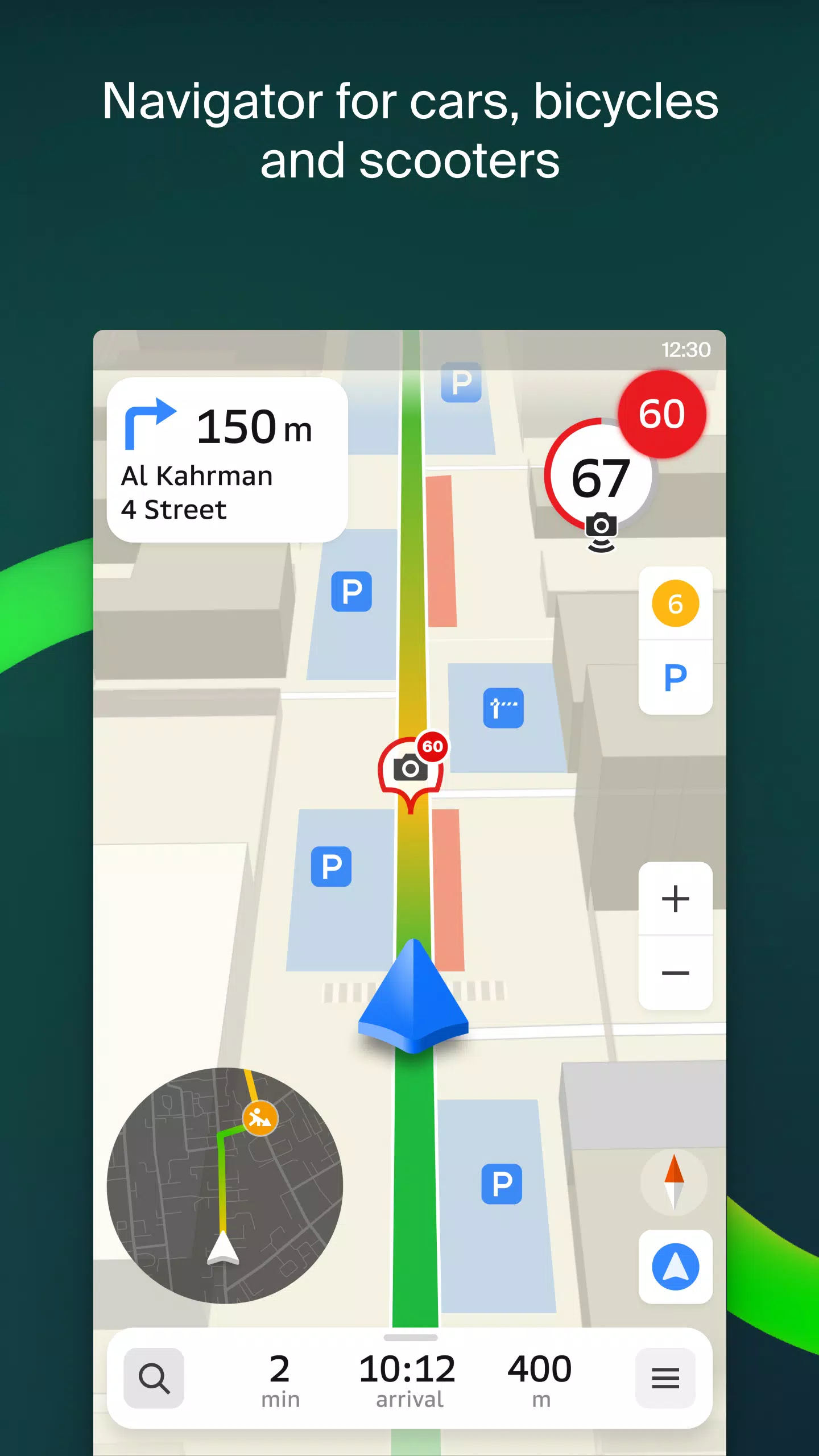
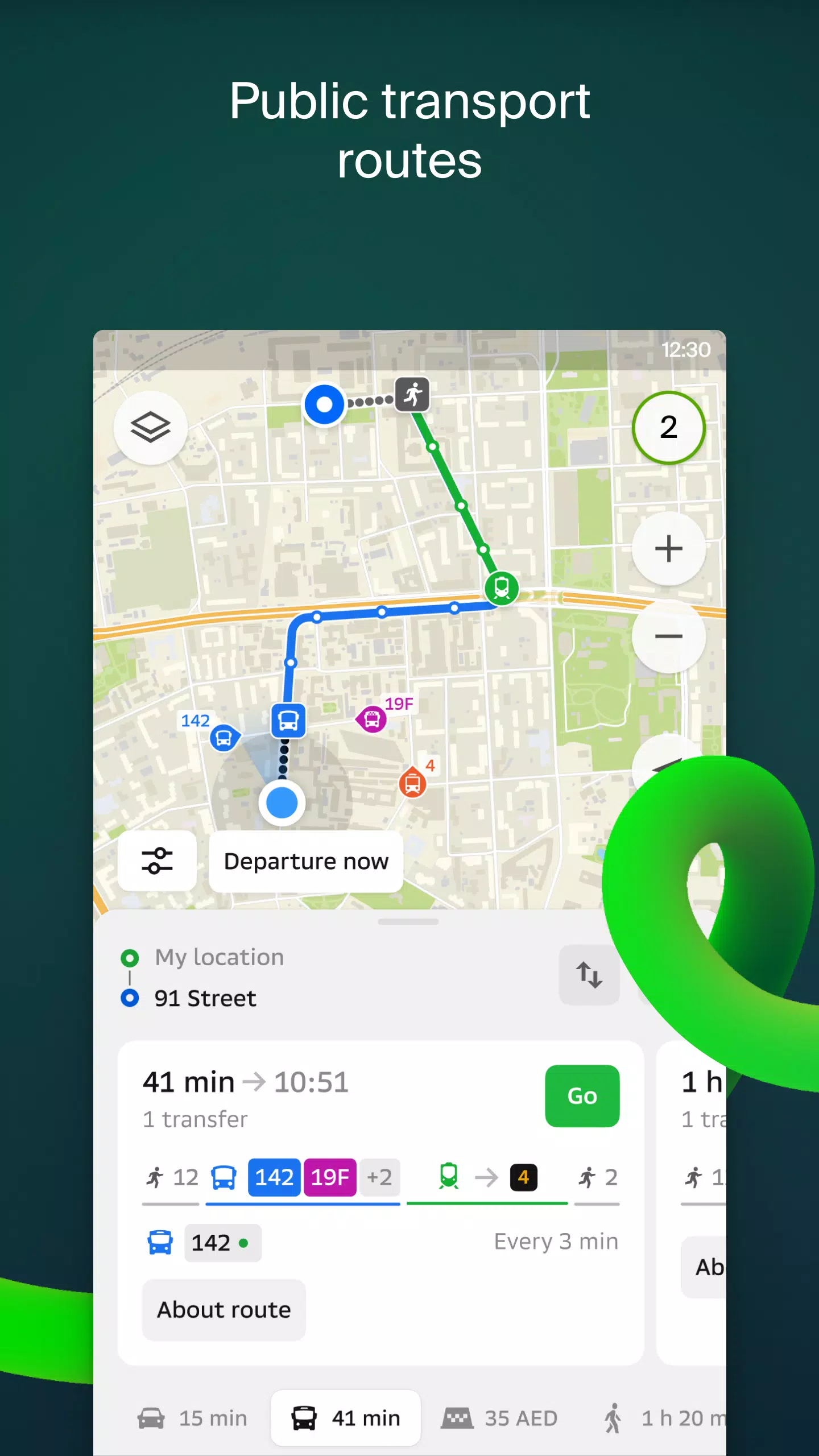
Driving? 2GIS guides you smoothly along the road with voice instructions and alerts you about upcoming maneuvers. It accounts for traffic jams and closed streets while updating your route if you veer off course. For pedestrians, it offers options for traveling via buses, metros, trains, cable cars, and river trams.
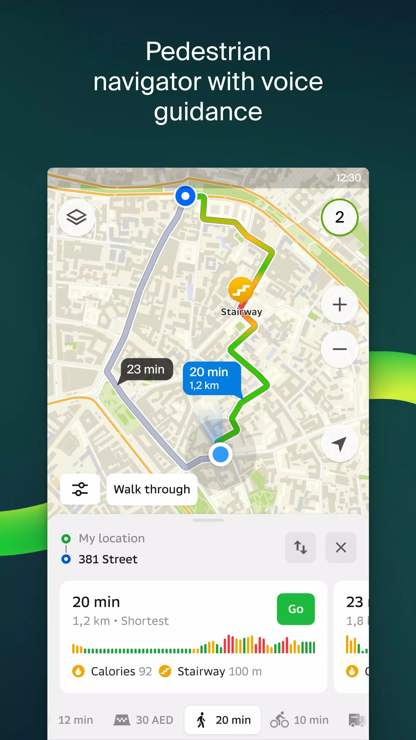
Walking Routes
Pedestrian navigation ensures you never get lost on foot. It works seamlessly in the background and supports voice guidance.
Friends on the Map
Now you can locate your friends and kids in real-time on the map! 2GIS displays their current locations. You control who sees your location by managing visibility settings.
Building Entrances
Need help finding an entrance to a business center? Look no further than 2GIS. The app knows how to direct you to over 2.5 million company entrances. Whether you're navigating public transport or driving, 2GIS will guide you straight to the door.
Shopping Center Plans
Navigate effortlessly within shopping centers using 2GIS. It shows everything—from stores and cafés to ATMs and restrooms. Plan your visit in advance to save time.
A 2GIS beta companion app for Wear OS smartwatches. A convenient tool for navigating routes on foot, by bike, or by public transport directly from your watch: view maps, receive maneuver prompts, and feel vibrations when nearing a turn or bus stop. The companion starts automatically when you begin navigation on your phone. Compatible with Wear OS 3.0 and later versions.
Be among the first to enjoy updates as bugs and errors are fixed and contribute to the development of a new version of 2GIS destined for millions of users. There’s no need to uninstall the original app—the beta version runs concurrently, allowing you to switch between the two anytime.
Support: [email protected]
What's New in Version 6.44.1.559.3
Last updated October 19, 2024
Stunning, high-definition updates just for you.
— Realistic, wide roads now appear on the main map and during route searches.
— Exciting Chats for Friends feature launched! Stay connected without leaving the map.
— Notifications alert you when friends are nearby (can be disabled in settings).
— Ski enthusiasts rejoice: ski lift statuses are displayed on slopes, showing whether they're operational.
— When your public transport journey includes walking, we calculate the walking portion in steps.